Tracking Environmental Change in Range Creek
Geographers use a variety of proxies to infer changes to the environment. Researchers associated with the Garrett Herbarium and RED Lab are using multiple lines of inquiry to reconstruct the climatic history of Range Creek Canyon.
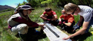
Stratigraphic Profiles
Over time, sediments are deposited in wetlands and along stream channels by various sedimentary processes. Sediment exposures along Range Creek provide the opportunity to study different depositional units and collect samples for pollen and charcoal analysis. These analyses can generate information on past vegetation, climate, and fire regimes for the area. So far, data from the stratigraphic profiles suggest that over a meter and a half of alluvium has accumulated on the flood plain surrounding Range Creek since AD 1300. This finding means that any Fremont features in the canyon bottom would be deeply buried and would not be apparent in surface surveys.
Sediment Cores
In a wet meadow or bog, organic sediments are being continuously produced and deposited over time. Incorporated in these deposits are other materials such as pollen and charcoal from the surrounding environment which are preserved in the wet environment. Along Range Creek is Cherry Meadows, a spring fed wet meadow that remains moist throughout the year. As part of a masters thesis and a field school research project, sediment cores have been collected from this location to reconstruct the vegetative and fire history of the Cherry Meadows area. Preliminary data suggest that it is likely that the Fremont were regularly burning the site for agriculture, fuel management, and/or to encourage desirable wild resources.
Pack Rat Middens
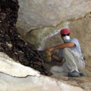
The preserved middens of packrats (Neotoma sp.) contain a wide variety of micro and macrobotanical specimens, and may preserve a rich record of the vegetation histories of the many microclimates in which they are found. The various Neotoma species are consummate collectors of a wide variety of organic floral and faunal materials (Dial and Czaplewski, 1990; Finley, 1958; Van Devender, 1990; Vaughan, 1990). This behavior, when combined with the preservation effect of induration by crystallized packrat urine (Spaulding et al., 1990), has created a rich source for paleoecological study of the last 50,000 years from many sites throughout the arid Southwest (Wells and Jorgensen, 1964; Wells, 1976; Spaulding, 1985; Van Devender and Spaulding, 1979; Mead, 1981). Past environments are reconstructed by the analysis of macro and microbotanical remains, as changes in vegetation (Cole, 1982) preserve details on environmental changes.
Larry Coats and his students propose to collect packrat middens from around Range Creek Canyon at varying elevations and from varying vegetation communities. The tremendous topographic relief in Range Creek Canyon (1500 m to 3050 m elevation) offers a great potential for detection of vertical movement of individual species that grow near ecotone boundaries. Because packrat midden data provides a detailed "snapshot" of the environmental conditions at a given time, but middens of various ages are randomly distributed in space. We will collect as many as 50 middens to try to create a tight chronology of vegetation and environmental change to link to the sedimentary analyses. We also propose to process middens for both macrofossils and pollen in an effort to derive more environmental information as well as trying to capture additional cultivar pollen.
Weather Station
In June, 2008 the Range Creek Research Project installed a permanent, commercial-grade weather station in Range Creek Canyon. The weather station in Range Creek was purchased with a generous grant from the Browning Foundation. The station was assembled and calibrated by Meteorological Solutions, Salt Lake City. The station continuously records wind speed and direction, temperature, relative humidity, barometric pressure, solar radiation, and precipitation. It accomplishes this using a series of solar and battery powered sensors supported on a 10’ steel tripod and a separate precipitation gauge. In 2013 a second weather station was added at a higher elevation.
The instrumentation includes: Datalogger. The data from the sensors are controlled and stored in a Campbell Scientific CR1000. Analog and digital inputs are stored and processed by the datalogger prior to transferring to a PC. The CR1000 is programmed to generate files for both 15 minute and hourly summaries.
-
Wind speed and direction data is provided by an R. M. Young Model 05103-L wind monitor sensor.
-
Temperature and relative humidity are measured by a Vaisala HMP50 temperature and relative humidity probe.
-
Barometric pressure is monitored by a Vaisala CS106 barometric pressure sensor.
-
Solar radiation variation is measured by a LiCor 200X pyranometer sensor.
-
Precipitation is monitored by a ETI Noah II total precipitation gauge.