Explorer Corps Marker: Weber County
Find the Marker
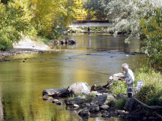
The Weber County marker is at the southeast corner of High Adventure Park, with a view of the Ogden River. The park is located at 251 18th Street in Ogden.
GPS 41°14’0.7692”N 111°58’23.43”W
Dig Deeper
Water is a powerful force in Utah. Rain nourishes deserts, natural springs create refuges for wildlife, and rivers can change the shape of the landscape itself. And in Weber County, the Ogden River played a mighty role in forming the landscape.

The snaking paths of the Ogden River run through parts of Utah’s Wasatch Range, mountains with a complex geologic past. More than 66 million years ago, during the latter part of the Age of Dinosaurs, the Earth’s crust in prehistoric Utah was being squeezed. Large sheets of rock were thrust up over each other into stacks. Now exposed, these great sheets of stone began to erode. Then, between 38 and 24 million years ago, large amounts of magma from deeper layers in the Earth began to intrude into the sheets of rock. This spurred a period of dramatic uplift, the combination of ancient rock and newly-created stone forming the Wasatch Range.
The mountains didn’t spring up overnight, of course, and the nature of the already-existing landscape altered the shape of the slowly-forming mountains. During the time that the Wasatch Range was rising, the ancient Ogden River was already flowing over the landscape and transporting sediment as it went. As the rocks rose higher, the Ogden River kept cutting into the stone – that’s how some of the area’s natural features, such as Ogden Canyon, formed. Think of pushing a piece of wood against a table saw and you get the idea of how water cut through the stone over millions of years.
All that uplift and erosion created the rivers and streams that many people in northern Utah enjoy every summer – from tubers to fishers. In fact, a restored section of the Ogden River was designated a “Blue Ribbon Fishery” along a 1.1. mile section of the waterway, the 46th such place to be recognized in Utah. These areas are designated not only for the abundance of wild fish, but for the care and quality of the surrounding habitats.
Want to Go Farther?
There are plenty of outdoor activities along the Ogden River, including fishing, tubing, paddleboarding, riverside hikes, and white water rafting.